
090 - West Virginia Back Roads
SKU:
090-PDF
$8.00
$8.00
per item
PDF File via download
Updated - April 2014
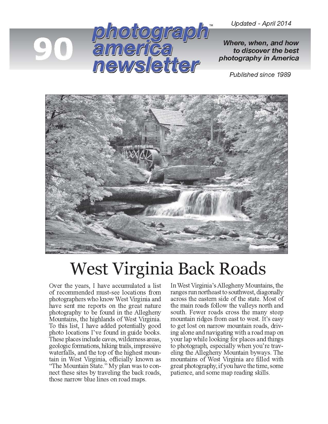
West Virginia’s Allegheny Mountain ranges run northeast to southwest, diagonally across the eastern side of the state. Most of the main roads follow the valleys north and south. Caves, wilderness areas, geologic formations, hiking trails, impressive waterfalls, and the top of the highest mountain in West Virginia.
No shipping or handling charges. No CA sales tax.
|
West Virginia's Allegheny Mountain ranges run northeast to southwest, diagonally across the eastern side of the state. Most of the main roads follow the valleys north and south. Fewer roads cross the many steep mountain ridges from east to west. It's easy to get lost on these narrow mountain roads while looking for caves, wilderness areas, geologic formations, hiking trails, impressive waterfalls, and the top for the highest mountain in West Virginia.
This newsletter describes the most photogenic sites along the back roads, those narrow blue lines on road maps. The mountains of West Virginia are filled with great photography, if you have the time and some map-reading skills. |
Locations
|