
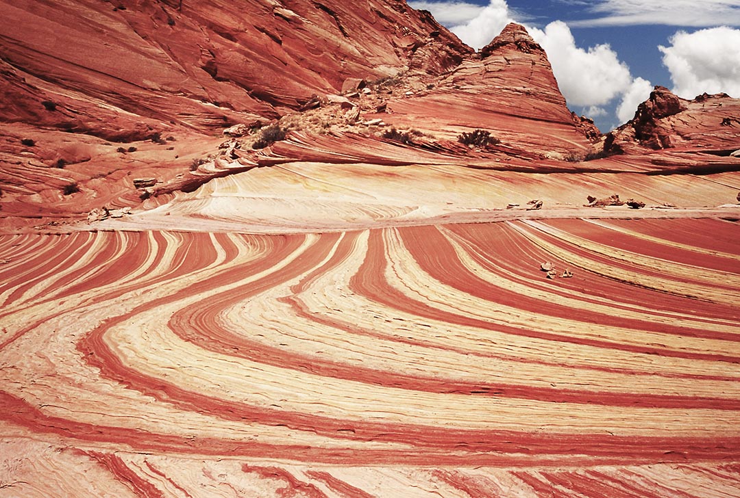
 Issue #099 - Successful Desert Photography When you’re hiking the trail to The Wave, and you reach the point where you can see the easiest route down and across the deepest part of the basin (across the sand) and up into The Wave, keep going south and stay on the western edge of the slick rock. In about a quarter mile, the route narrows, with a low, vertical wall rising on the left and a tall and steep redrock wall on the right. Continue walking south, past a strange pattern of concentric circles about three feet in diameter. As the route starts to turn left and slopes down into the wash, the trail passes a large area of red and white stripes (in this photo), bisected by more stripes running north and south to create another dramatic desert pattern. This slick rock formation bears east and drops into the main wash down the center of the North Unit of Coyote Buttes. To reach The Wave, head left and walk north, down the sandy wash, following the bottom until you reach a drop-off that’s too steep and deep to safely descend. At that point, climb up the sandy slope to the right until you reach the southwestern opening into The Wave. This route takes about thirty minutes longer than following the most direct route to the Wave but you will discover many more interesting patterns along the way.
You can find more information on Successful Desert Photography in Issue #99 of Photograph America Newsletter. Comments are closed.
|