
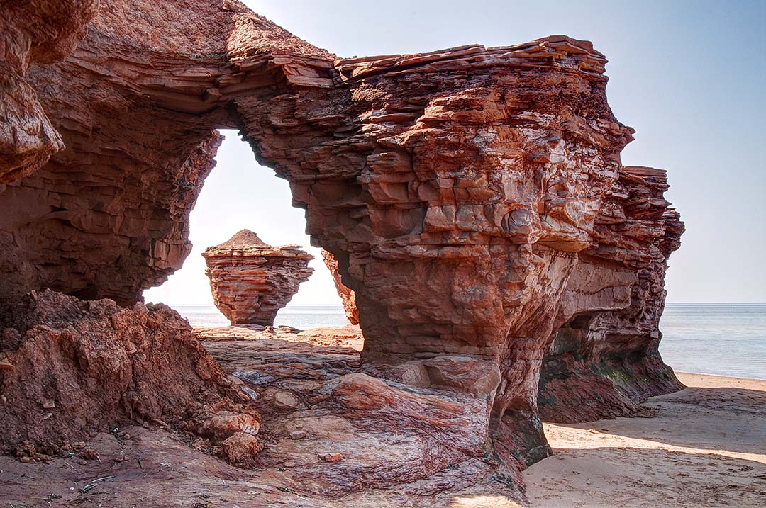
 Issue #131 - Prince Edward Island, Canada On the north shore of Prince Edward Island, 3.5 miles east east of the village of Malpeque, watch for Lower Darnley Road on Route 20. Turn north and drive until you see a sign at the junction of Thunder Cove Road. A couple minutes on this gravel road will take you to the edge of the cliffs above Thunder Cove. Park in the middle of a large curve in the road and you’ll find a narrow trail leading 65 feet down the cliffs to the beach. Down on the sand, walk 15 minutes west to find some bizarre geological formations carved by storm-driven waves blowing in from the north. Arrive during a high tide and you’ll have trouble getting around the points extending farther into the ocean. A lower tide will expose more of the strange formations and reveal reflecting pools that mirror the images you’ll want to photograph.
Depending on which way you’ll be shooting, these formations will work for you in morning or afternoon light. A thick fog will add drama to the scenes. A sky full of clouds will be better than a bald, blank sky. If you will be passing through here just once, photograph what you find and work with it later. Allow at least an hour for the beach hike and a thorough photo session. Avoid summer weekends here when this beach is covered with tourists and all the parking spaces are full. 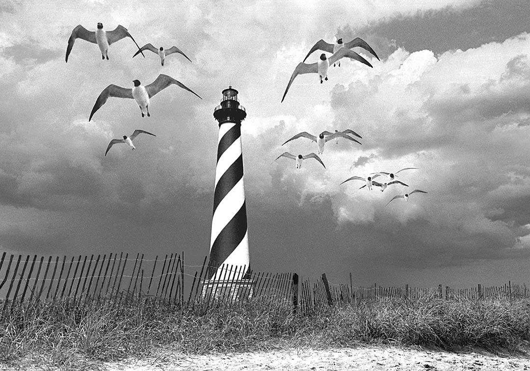 Issue #037 - The Outer Banks of North Carolina The Outer Banks are a long, narrow band of barrier islands extending a hundred-and-fifty miles down the coast of North Carolina. This fragile, offshore ribbon of constantly shifting sand separates the Atlantic Ocean from coastal bays. While staying two nights at a small motel in Buxton, near the southern tip of Hatteras Island, North Carolina, I got out on the beach for two sunsets and two sunrises. The most dramatic cloud formations over the Cape Hatteras Lighthouse formed during the late afternoon when thunderstorms darkened the skies to the north. Some of the most satisfying images I made during my week of exploration along the Outer Banks were patterns of beach grass, and wind-blown sand ridges sandwiched between the surf and the sky. Patterns of sand fences, half-buried in the dunes, created leading lines and gave a greater feeling of depth to my beach scenes.
To save the Cape Hatteras Lighthouse from the encroaching sea, it was moved a half mile inland in 1999. The lighthouse is now the same distance from the ocean as when it was originally constructed in 1870. Known as America's Lighthouse, the Cape Hatteras Lighthouse stands 208 feet and is the tallest brick beacon in the nation. 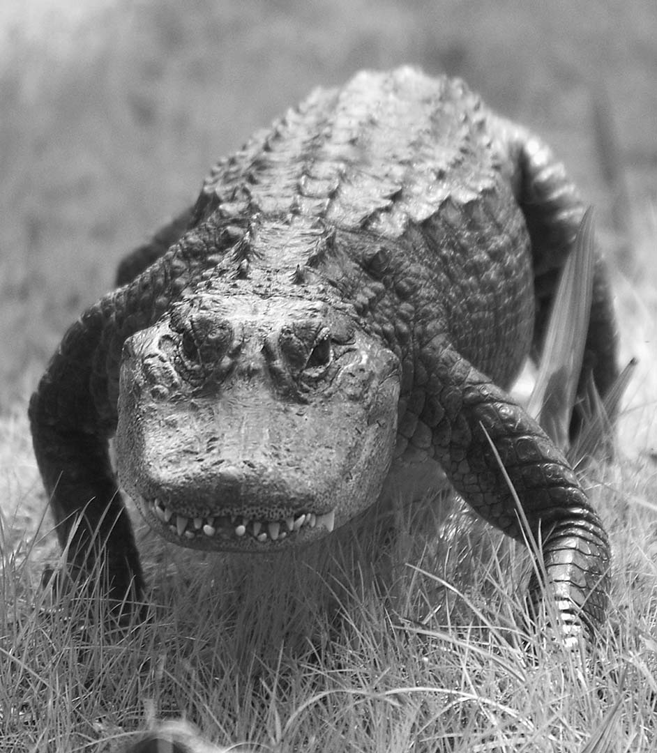 Issue #122 - Florida's Panhandle Coast Out in the Big Bend of northwest Florida, the mouth of the Suwannee River is twenty miles from US 19 to the small coastal village of Suwannee. Just before reaching the village, I spotted the side road marked with a sign pointing out the Lower Suwannee National Wildlife Refuge. Five miles into the refuge, palms scattered across the marshes near the Sanders Creek bridges made some nice compositions. A trail headed downstream along the edge of Sanders Creek. I got quite a distance from the road and my car as I photographed palm tree reflections in the dark stream and great white herons perched on cypress knees. Coming up the trail, headed straight for me, I thought I saw a large black dog. Standing two-feet tall and striding along briskly, it suddenly stopped as it noticed me and my camera. It turned and slipped into the stream. I could see that it was a very large alligator. I quickly returned to the car. The Lower Suwannee National Wildlife Refuge covers almost 53,000 acres. It would be easy to get lost in this swamp.
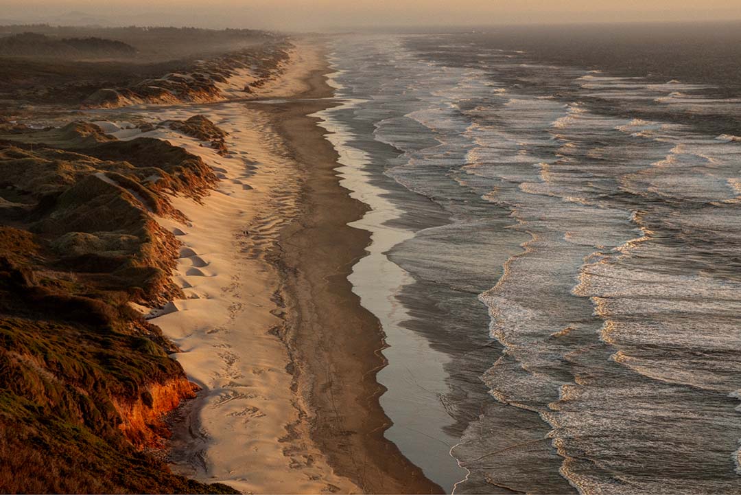 Issue #100 - Oregon Lighthouses If you have ever traveled the coast of Oregon to photograph lighthouses, Florence is the town just south of Heceta Head Lighthouse. The action to the south of Florence is found on the 42 miles of sand dunes called the Oregon Dunes National Recreation Area, stretching from Florence as far south as Coos Bay. Take the first right turn after crossing the Siuslaw Bridge heading south. Drive out to the end of the jetty to find many trails that climb over a long ridge line of tall dunes, the largest coastal dunes in North America and some of the tallest, at over 500 feet in height. The dune trails are steep and the sand is soft. To find easier sand dune photographs, drive about 5 miles north of Florence to find several high viewpoints on 101, looking south, that are especially nice at sunset.
|