|
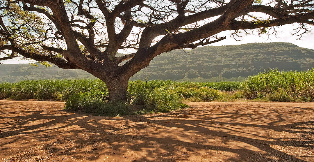
The longest white sand beach in the entire chain of Hawaiian Islands is located a few miles west of Kekaha, an old sugar mill town in the southwest corner of Kauai. To find Polihale Beach, drive west, past the Barking Sands Airfield and the Pacific Missile Range Facility, to the end of the pavement on Highway 50. Steer to the right at the fork and drive about a half-mile to a left turn onto an unpaved and pothole-covered road through the cane fields. Reset your trip odometer and drive three-and-a-half miles from the pavement to a junction beneath a huge monkeypod tree. After a stop to photograph it, turn left at the tree and drive about a half-mile west to the beach. Park and climb over the dunes to the longest and most deserted beach in all the Islands. You’ll find very few people out there on the southwestern edge of the island. It’s a wonderful place for panoramic photographs around sunset time.
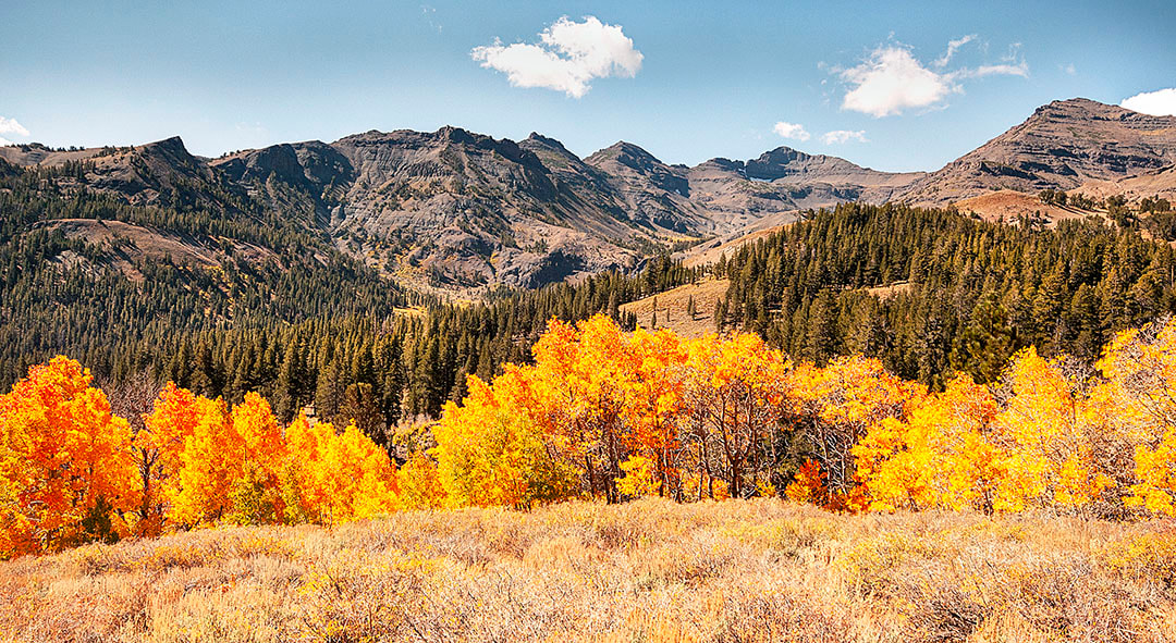
On my map it’s called Sonora Junction, the point where Hwy. 108 ends at Hwy. 395 in the middle of a treeless landscape. This plateau stretches south for ten miles to Mount Emma, at 10,525 feet. You can see different colors of aspen groves climbing the slopes. Aspens reproduce by cloning. Every tree in a grove can be the same color and markings on trunks can be identical. Sonora Pass autumn color is found between Hwy. 395 and the summit at the top of the pass at 9624 feet. The U.S. Marine Winter Warfare Training School is located on the Sonora Pass road, a couple miles west of Hwy. 395. Most of the aspen color along the Sonora Pass is found between the U.S. Marine training center and the summit located 17 miles farther west.
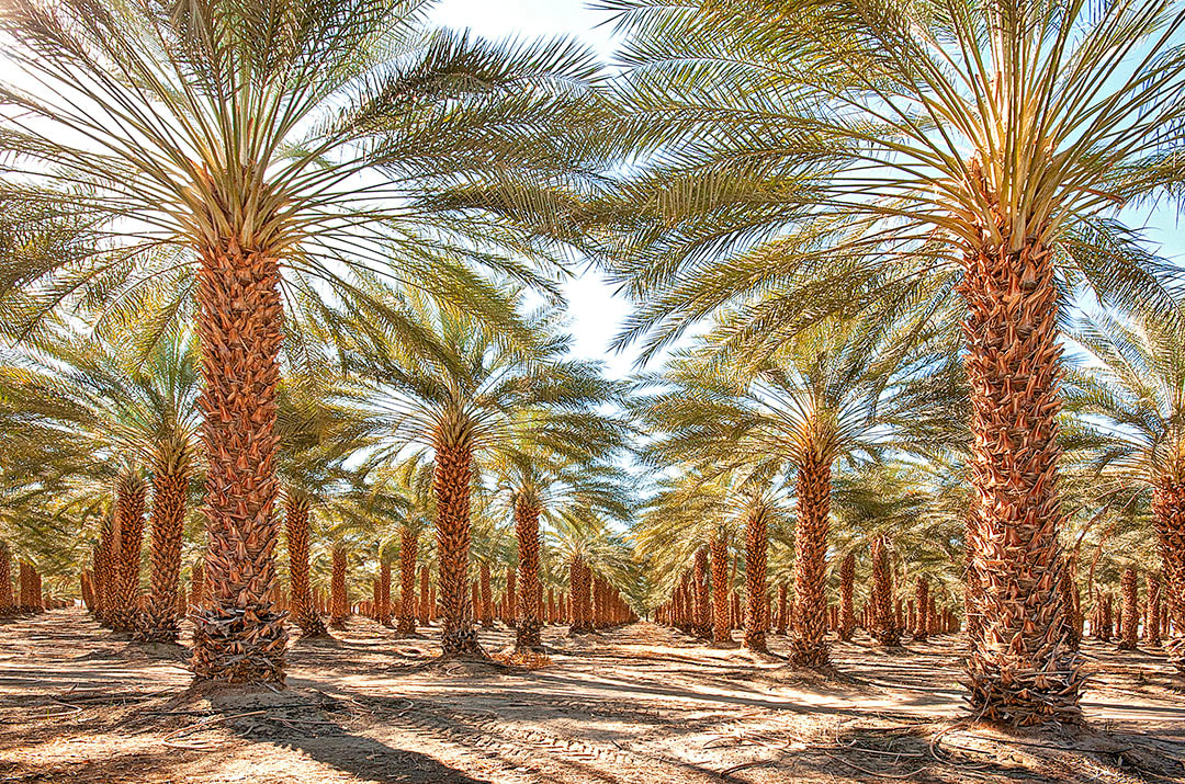
At the north end of the Salton Sea, huge groves of date palms line Highway 111, south of Indio. Pick a side road that cuts through a grove and find a spot to park with a view of tall palms stretching far into the distance. Compress your view of the groves with a telephoto lens or expand it with an ultra-wide lens. The date industry in the Coachella Valley dates back to the late 1800s when thousands of shoots were imported from Algeria. Today, the town of Indio produces 85% of the dates grown in the United States. Groves that once covered the northern stretches of Coachella Valley have been replaced by development.
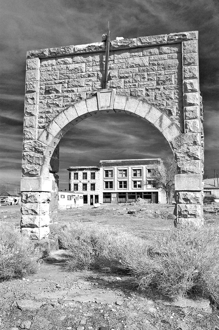
Twenty-seven miles south of Tonopah, NV, Highway 95, on its way to Las Vegas, runs right through the center of the town of Goldfield. There are plenty of relics of past glories to be found here. The stone archway of the old athletic club still stands on a side street, called Main Street, about a block from the highway. The west side of the stone arch is most ornate and frames the Ish-Curtis Building (1907), one block to the east. This view is best in afternoon light, like the front of the Goldfield Hotel. Many of the biggest and most impressive structures face the west and the setting sun. The old school house, now undergoing renovation, faces the east.
|
BlogNotes and images from Bob Hitchman. Archives
July 2024
|


