|
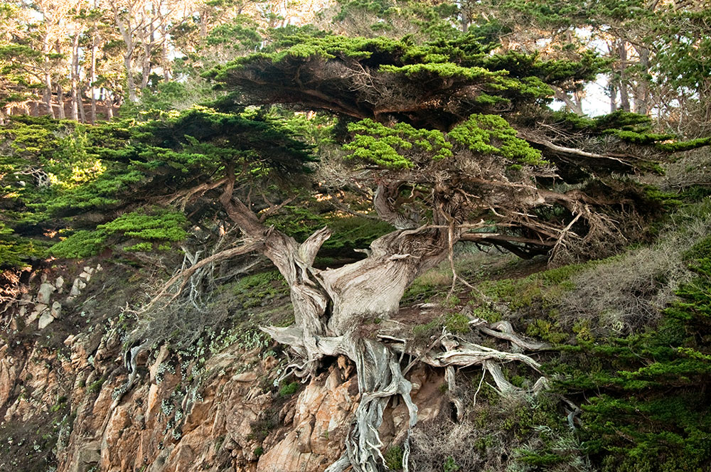
Point Lobos State Reserve is a great place to visit on a foggy day. Cold mists add a dreamy atmospheric effect to dense cypress groves and pine forests on rocky headlands. The entrance gate is four miles south of Rio Road. This reserve has a limited number of parking spaces. On a busy summer weekend, you may have to wait at the gate for someone to leave. You can park outside along the highway and walk in to save the entry fee. New trails have been added and old trails have been improved, but the landscapes across this State Reserve have not changed at all. Everything looks as it did thirty years ago. Pick up a free map at the entrance gate, drive out to the parking area at the Information Station. Along the Cypress Grove Trail use your wide-angle lens to include wind-sculpted cypress trees framing a rugged coastline of cliffs receding for miles into the hazy distance. From the Information Station, head northwest on the North Shore Trail. Take a short side trip to photograph the Old Veteran Cypress still clinging to the granite cliffs above Cypress Cove. The North Shore Trail passes through some ancient cypress groves and skirts the edge of rocky cliffs for views of offshore rocks and Blue Fish Cove.
I found this image at Gulf Islands National Seashore Visitor Center, across the bay from Pensacola, Florida. Route 399 heads south over the Santa Rosa Sound. A long toll bridge connects the mainland to Santa Rosa Island. On the island, turn right at the traffic light and head west. Pay the entry fee or show your National Park Pass at the gate and drive six miles farther to Gulf Islands National Seashore at the western tip of this island.
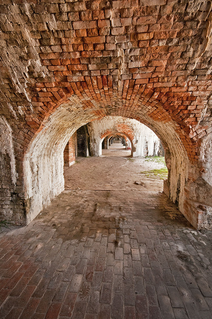
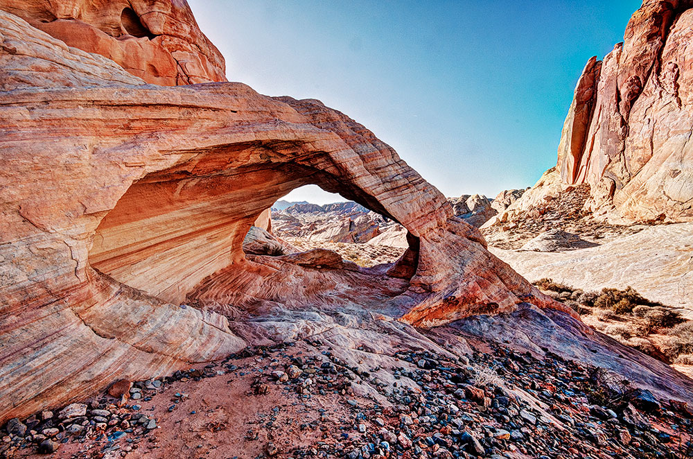
During the earliest years of America’s history, military forts were necessary to protect this country’s harbors from foreign invaders. Fort Pickens was the largest of four forts built to protect Pensacola and its navy yards. The fort was begun in 1829, completed in 1834, and used until 1947. Follow the signs to Fort Pickens, park in the lot and walk through the entrance at the Visitor Center. Pick up a free tour guide and map of Fort Pickens. To find the best photo locations, continue out through the Visitor Center and bear right to walk through the long western bastion to photograph a long row of ancient and weathered brick archways that supported massive cannon emplacements. In the middle of the western bastions are stairs to the top where you will find a huge 15” (bore) cast iron cannon pointing toward the narrow opening from the Gulf into Pensacola Bay and the harbor that was protected for over a hundred years by Fort Pickens. Brick arches and very thick walls supported the weight of many cannons along the parapets. Thick exterior walls also protected the fort from enemy fire. The only time Fort Pickens was under fire was during the Civil War. There are many gun ports but no windows in the soldier’s quarters. Some daylight filters into most parts of the fort. A tripod will allow you to use a small aperture and low ISO for greatest sharpness when you are photographing repeating patterns of arches extending into the distance. On the west side of Parking Area #3 in the Valley of Fire State Park is a trail down a ravine that leads to several arches. Park at the far right end of the #3 parking lot and pull out your gear. Along with the mandatory tripod, you’ll need your shortest wide-angle lens, like a 10 mm, and a zoom lens in the 24-120 mm range. These arches face the west and should be photographed in the morning. During my midwinter trip, I was out there at 7:00 am and found both arches in the shade. Only an overcast day with a sky filled with dramatic clouds would be better. Lock up your car and walk fifteen feet to the west, away from the pavement. Follow the footprints in the sand down the ravine. In three hundred feet, at a point where the ravine begins to widen, you will see the first point where another ravine leaves the one you’ve been following and heads to the right. At that point, you can see a large white formation in the distance on the right side of the trail. Look carefully and you can see the arch called Fire Cave on the left side of the same trail. While you are standing beside the Fire Cave, turn and look in the other direction across the ravine. That canyon wall is white and on the other side of that wall is the next arch you’ll want to find and photograph. Continue downstream to a point where the canyon ends and a high sandy bank covered with sagebrush begins. Turn right here and climb the sand dune. At the top of the dune, head to the right again and make your way up another parallel ravine. You can walk down the other side of the sand dune and head up stream, or you can stay high and walk up the sandstone ridge. By staying on the sandstone, you will walk through this white arch in 50 feet. If you walk up the sandy bottom of this ravine, you will go past the arch where you will find an easy stair step route up and onto the slick rock. It’s hard to get low enough to include much sky in this opening. I was lying on my stomach with my camera on a GorillaPod. Then I backed off and tried a 120 mm lens from a spot on the edge of the wash.
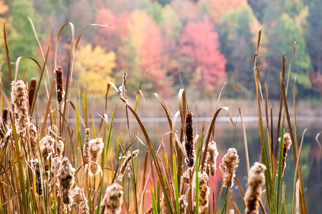
Autumn color moves into southern Vermont, New Hampshire, and along the coast of Maine during the first two weeks of October, a good time for lighthouse photography. Fly in and out of Rochester, NY to photograph New York’s Finger Lakes District from October 5 to October 20. Allow several days to photograph autumn color in Letchworth State Park, not far from the Rochester Airport. Acadia National Park usually sees the peak of fall color by October 10, about the same time New York’s Lake District and Nova Scotia’s Cape Breton reaches the peak of color. Mid-October is the best time to drive the Skyline Drive through Shenandoah National Park in Virginia. State Parks, like Macedonia Brook, in northern Connecticut see their peak color during the third week of October. Ohio’s Cuyahoga Valley National Park also sees the peak of autumn color during the third week of October. Autumn color spreads south, along the Blue Ridge Parkway, to The Great Smoky Mountains National Park, where the color peaks in late October. Nevada has four great autumn color locations: Rainbow Canyon, Mt. Charleston, Lamoile Canyon, and Wheeler Peak in Great Basin National Park. Cottonwoods in Arizona’s Canyon del Muerto and Canyon de Chelly are bright yellow during the last week of October. Most of the cottonwoods along the Virgin River through Zion National Park are bright yellow in late October through the first week of November when the river level is usually low enough to safely wade up the Zion Narrows.
|
BlogNotes and images from Bob Hitchman. Archives
July 2024
|


