|
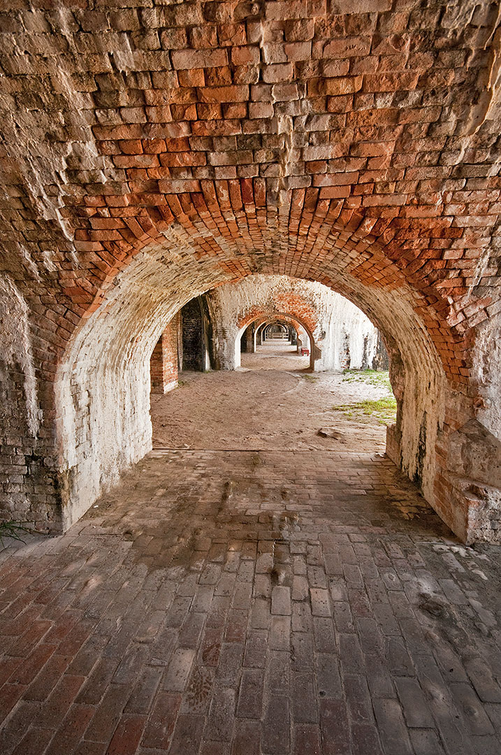
I found this image at Gulf Islands National Seashore Visitor Center, across the bay from Pensacola, Florida. Route 399 heads south over the Santa Rosa Sound. A long toll bridge connects the mainland to Santa Rosa Island. On the island, turn right at the traffic light and head west. Pay the entry fee or show your National Park Pass at the gate and drive six miles farther to Gulf Islands National Seashore at the western tip of this island.
During the earliest years of America’s history, military forts were necessary to protect this country’s harbors from foreign invaders. Fort Pickens was the largest of four forts built to protect Pensacola and its navy yards. The fort was begun in 1829, completed in 1834, and used until 1947. Follow the signs to Fort Pickens, park in the lot and walk through the entrance at the Visitor Center. Pick up a free tour guide and map of Fort Pickens. To find the best photo locations, continue out through the Visitor Center and bear right to walk through the long western bastion to photograph a long row of ancient and weathered brick archways that supported massive cannon emplacements. In the middle of the western bastions are stairs to the top where you will find a huge 15” (bore) cast iron cannon pointing toward the narrow opening from the Gulf into Pensacola Bay and the harbor that was protected for over a hundred years by Fort Pickens. Brick arches and very thick walls supported the weight of many cannons along the parapets. Thick exterior walls also protected the fort from enemy fire. The only time Fort Pickens was under fire was during the Civil War. There are many gun ports but no windows in the soldier’s quarters. Some daylight filters into most parts of the fort. A tripod will allow you to use a small aperture and low ISO for greatest sharpness when you are photographing repeating patterns of arches extending into the distance. Comments are closed.
|
BlogNotes and images from Bob Hitchman. Archives
July 2024
|

